
Evaluation of seismic models using data of earthquakes in the Belgian Hainaut province
In a recently published article in Bulletin of Earthquake Engineering, researchers from the seismology department of the Royal Observatory of Belgium evaluate the applicability of existing models to calculate ground motions due to earthquakes in the coal basins of the Belgian Hainaut Province.
During the 20th century, more than 25 earthquakes occurred here with magnitudes between 2.9 and 4.1, presumably triggered by the large-scale coal mining in the region. Due to their shallow depth (only a few kilometers), these earthquakes were strongly felt by the population and even caused damage to buildings. Unfortunately, because these earthquakes all occurred at a time when there was no modern seismic network, no digital records are available. However, it is also possible to compare the models via an intermediate step with macroseismic intensity data (= a measure of the shaking at the Earth’s surface during an earthquake based on the effects on people, objects and buildings) gathered from the numerous testimonies in a previous study.
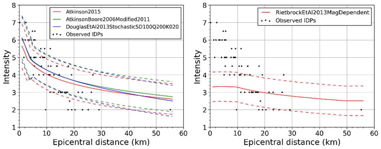
Figure 1 – Comparison between observed intensities (black circles) and intensity models (solid lines) with their uncertainties (dashed lines) as a function of distance for the April 3, 1949 Havré earthquake (magnitude 4.1). Left: the three best-fitting models; Right: one of the worst-performing models.
For more than 20 models, our researchers calculated the goodness of fit with the data according to various measures, including a self-developed measure to evaluate the distance trend separately. The compilation of intensity data had already shown that intensities in the Hainaut coal basins decrease much faster as a function of distance than elsewhere in northwestern Europe. Our analysis shows that no international model really matches the data well, especially in terms of the distance trend, demonstrating the uniqueness of this region. Nevertheless, we were able to select three models that clearly outperform the others (Figure 1). The selection of suitable ground motion models is important to compute new seismic hazard maps and possibly also to generate ShakeMaps (Figure 2) in case of potential future earthquakes in the region.
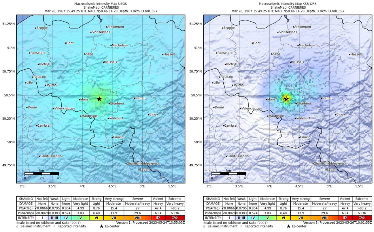
Figure 2 – ShakeMap calculated for the March 28, 1967 Carnières earthquake (magnitude 4.1). Left: based on ground motion models developed for stable continental regions; Right: based on the models selected in this study.
Reference paper:
Vanneste, K., Neefs, B. & Camelbeeck, T. Testing the applicability of ground motion prediction equations for the Hainaut region (Belgium) using intensity data. Bull Earthquake Eng (2024). https://doi.org/10.1007/s10518-024-01958-1